Aerial views of the site near the Kapowsin airstrip we are developing.
First we saw this parcel online in real estate listings, then we examined from the air using Pierce County's publicGIS. We extracted the images of the gallery through screen captures and compositing them with official drawings.
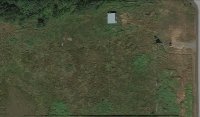
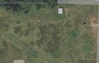
Image 1 shows a basic view of the parcel. Image 2 shows the same with an indication of the flow of water in wet times.
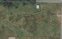
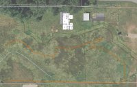
The lines in images 3 and 4 indicate:
- Orange: wetland delineation
- Dark green: wetland buffer - 37.5' away from the wetland
- Light green: building setback - 15' from the buffer
Outside those enclosed areas, (1 and one-half to two of the total 5 acres!) we can do just about anything we please!